



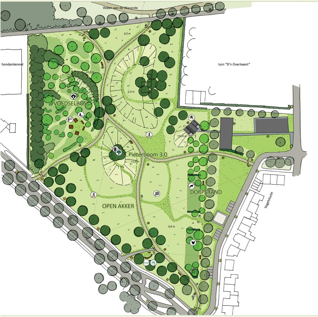
 Plan landscape park D'n Steenakker designed by Barbara Roozen.
On this spot there used to be fields that together were called the Gilzesche Steenakkers. The name 'Steenacker' can already be found in the 1456 tax book (cijns = tax). The word stands for poor and difficult to cultivate land with lots of cobbles and stones. If you put two maps - from 1762 and 1996 - side by side, you will see that this landscape park occupies the last point of that Gilzesche Steenakker. The other vast majority has already been built up with houses over the years: the Steenakkers neighbourhood.
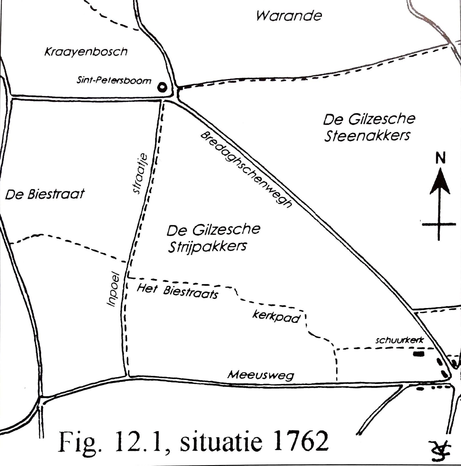
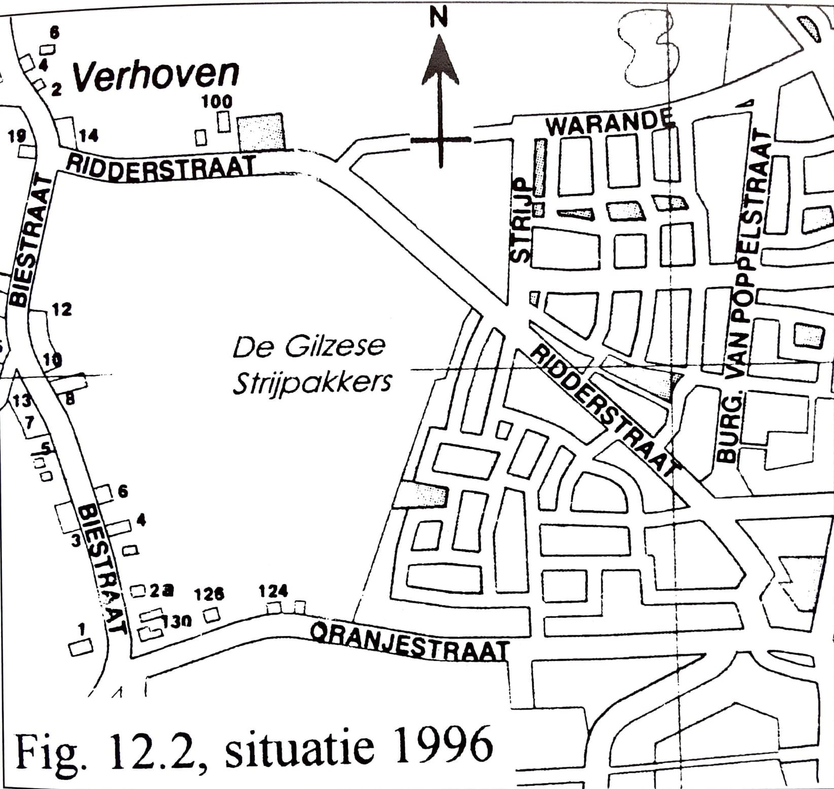 Situation Steenakkers in 1762 and in 1996 (drawn by Jan de Vet). What was still called Bredaghsenweg in 1762 is now Ridderstraat (Images archive Heemkring Molenheide).
The three-part Peter's or Peter's tree that stands on the hill in the middle of the new park is the physical link to history. According to a deed, there was already a 'Sente Petersboem' just next to this park area in 1416. In 1851, Meester Schrauwen (headmaster of the Gilze school) wrote that processions were held in earlier times, from the church to the tree and back again. This custom dated back to the time of the Germanic people and was adapted to Christian tradition. By the end of the 18th century, the tree must have disappeared. Landscape park designer Barbara Roozen writes on her website: 'Now is the time to transform an old tradition into a new one, so that the trees remain honoured. Creating a nice place under the tree would allow people to connect with nature. But it could also become a 'selfie tree', where people honour themselves with a nice Instagram photo, with the tree as a beautiful green background'.
What also appeared in the tax book in 1456 was the indication 'aen de Warande'. Another hint of the history you find in the current street plan (adjacent to the park). A very special history, because this brings you to the Princes of Orange. Warande stands for 'protected hunting ground' and before 1795, the Prince of Orange had hunting rights here in this wooded area as Lord of Breda. Only the lord or his proxy was allowed to hunt big game such as red deer, wild boar and roe there.
Near their hunting grounds at that time, the Princes of Orange had a hunting lodge, called the Hooghuis. In Middle Dutch, Hoochhuus means 'castle or castle'. This was probably a stone hunting lodge with a storey, overlooking the hunting grounds. In 1758, according to some writings, the castle was still there; in 1802, when the hunting clamps (the area where someone was allowed to hunt for a fee) were classified, it had disappeared. It was long suspected to have stood near this park. Master Schrauwen even wrote in 1854 specifically 'where Ridderstraat and Biestraat meet'. More recent research points more in the direction of Klein Zwitserland, which incidentally is not that far from the park as the crow flies; cross the A58 diagonally, so to speak, and you are there. Until 1940, the Warande area remained mainly pine forest. The Germans cleared the trees in the first year of their occupation to build the military airport (then called Fliegerhorst).
And that military airfield brings us to the Hudson bomber, which crashed burning in today's hiking area during World War II. At 01.30 on the night of 1 June 1944, the airfield's anti-aircraft guns brought down the low-flying British aircraft. It was a spy plane with an undisclosed destination and also had two Dutchmen on board. Their intention was to land with their parachutes and then make contact with the Dutch resistance. The English pilot and his navigator sent the Hudson - probably due to a navigation error - straight over Gilze-Rijen airfield. The plane crashed into the cornfields. All six occupants were killed.
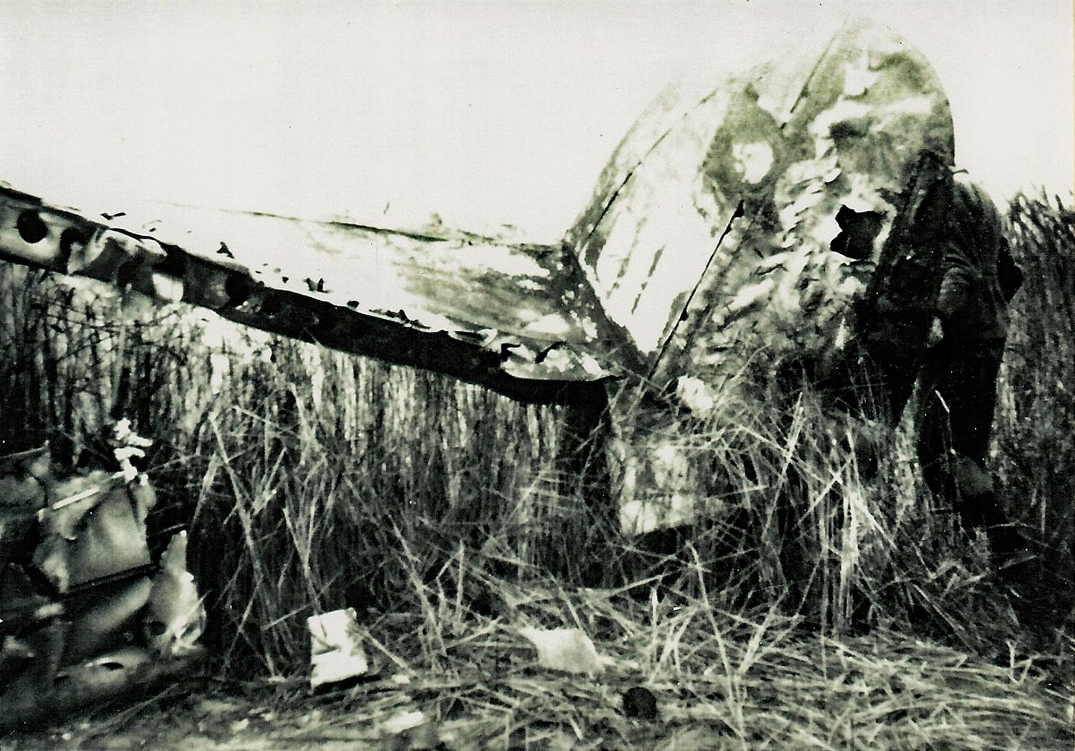 The crashed aircraft (photo archive Heemkring Molenheide)
And all this time, nobody had any idea that beautiful archaeological finds were waiting to be discovered in this area underground. Fortunately, in 2000, Thom Smekens was alert to this fact during earthworks on his land just next to D'n Steenakker. Archaeologists then bent over the soil of the former Kraayenbosch for seven working days, scraping layer by layer and uncovering nine skeletons, six knots, dust remains and nails (from the wooden boxes). They were remains from the Eighty Years' War (1568-1648). To be precise, from 1624/1625 of Spinola's army. This Spanish general besieged the city of Breda for a long time and (also) had his encampment in Gilze. The soldiers died of disease or gunshot wounds.
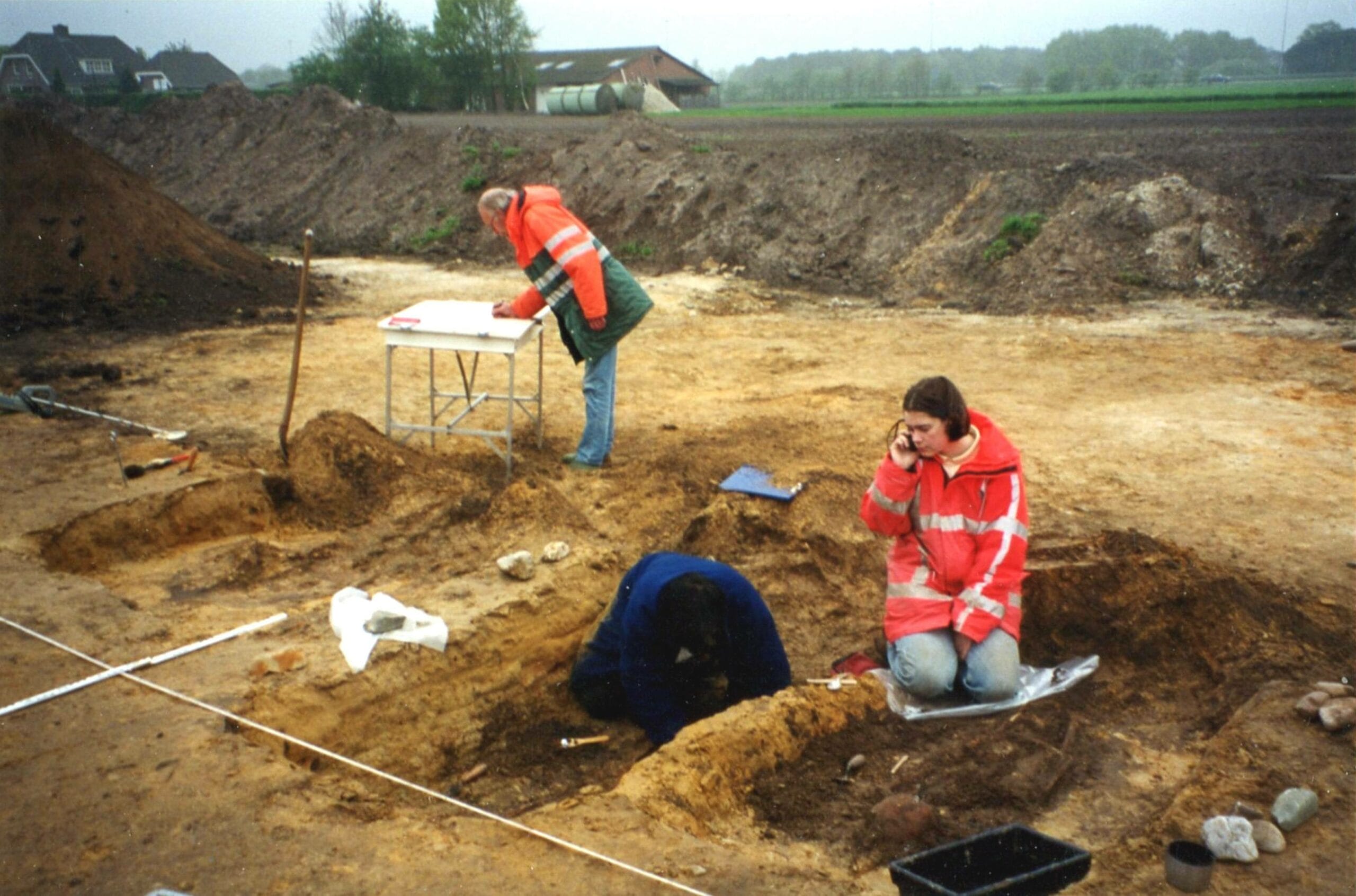 Archaeologists at work during the excavations in 2000 (photo archive Heemkring Molenheide)
Encouraged by these soil finds, Thom Smekens also closely followed excavations on his land in 2001. The 45 colourful beads he found triggered excavations again, adding hundreds of years to the history of Gilze. Because archaeologists discovered a burial field from the Merovingian era, which they dated to about four hundred AD. They uncovered sixteen graves. Apart from the beads, they found a sword, a glass goblet, cloak pins, grinding stones and parts of a buckle.
But what really put Gilze a lot earlier in time were the traces in the ground of two Iron Age farms a hundred metres away. Because then you are talking about the period 800 to 250 BC. The archaeologists also discovered traces of 'spiekers', small buildings with a raised floor, which served as storage sheds for agricultural produce. The post marks and some buried storage jars pointed to longer habitation. The archaeologists also found seeds, grinding stones, spindles, bones and pieces of pottery. The pottery allowed for a fairly good dating and provided evidence that there had been habitation near Gilze since four hundred BC.
 Bead necklace from the Merovingian era, found during excavations in 2001 (photo archive Heemkring Molenheide)

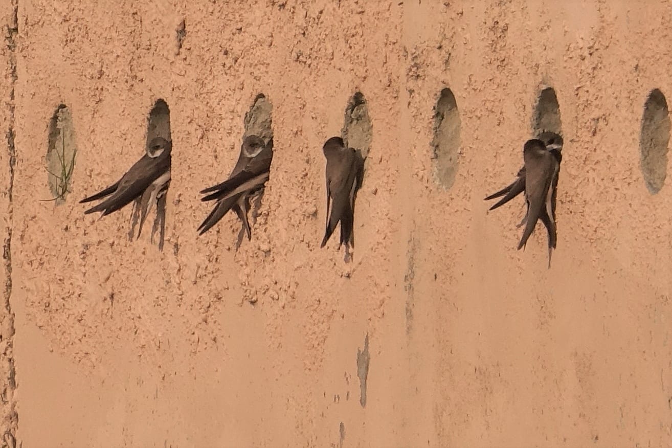
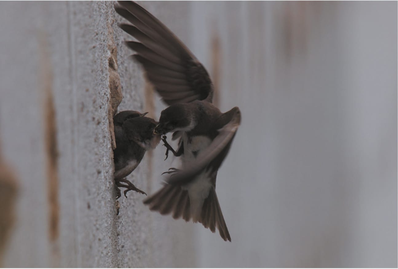
At the 'Water on the Warande', it is worth going there to look at the swallow wall (a civic initiative). Sand excavations more often attract the attention of the little riparian swallows.
At the Warande, the white sand was first brought up by crane trucks etc. It was buffered on the bank into decent mountains. When the pit filled up with bottom water, a flat-bottomed boat and a large tube were used. Thus, the extracted sand was sucked up and then sprayed to dry. Those mountains of fairly solid white sand could not be processed directly. The shore swallows saw that as an opportunity. They dug their nesting tubes in the sand wall and took advantage of their protected status. In turn, the naturalists also saw that as an opportunity. Consultations resulted in an artificial bank swallow wall.
And with success. Every year a large colony of swallows breeds there Only one year did they skip. They were then disturbed by people who could easily enter the nesting island because of the drought.
'The natural value of the airbase is greater than you think. That value lies in particular in the presence of a large area of heathery grassland, old moorland and the alternation with diverse standing forest. The land next to the airport runways has a fairly loose topsoil, ideal for sand bees The airbase is among the most valuable nature reserves in Brabant. (according to beekeeper Aad van Diemen).
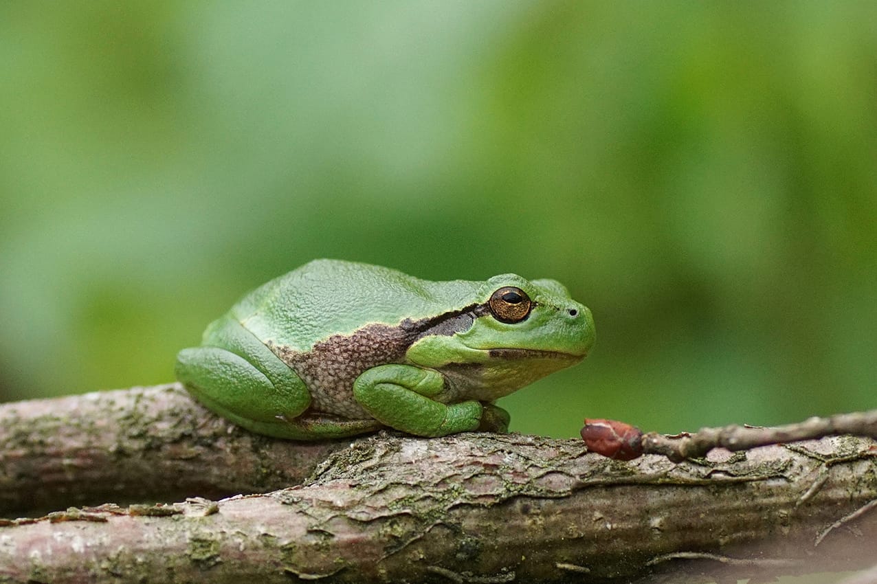
The crown jewel of the base is the tree frog, which incidentally does not live in trees. For climbing and scrambling, it prefers brambles (and the presence of water, of course.
This small frog with great cuddliness was almost extinct as a result of inbreeding, among other things, but 'human hands' have provided new blood! A successful ecological link road was created for the tree frog from A to B and vice versa. Say a luxury route with food and resting places at appropriate distances.
We now observe the tree frog in a much larger area south of the air base.
Sand consists of loose grains formed by erosion. Say, ground into grit by weather and wind. They are actually mineral particles of 0.06 to 2 mm, formed by erosion of rocks. Water (river or sea) also contributes to this erosion. This white sand is permeable to water, making it a solid, compact support for a building, for example. A mountain of sand cannot be compressed.
Boulders, you find them everywhere here. Sometimes they served or do serve as boundary stones but just as often they function as protection for corners and walls of houses and stables.
You have to realise that here you are near the famous (Gilze-)Rijen fault. That is a fault plane deep in the earth's crust. Many large boulders have worked their way up from that fault over time. Where did these boulders originally come from?
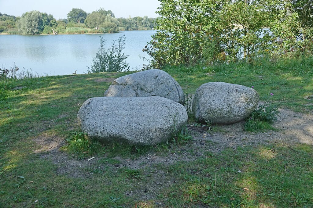
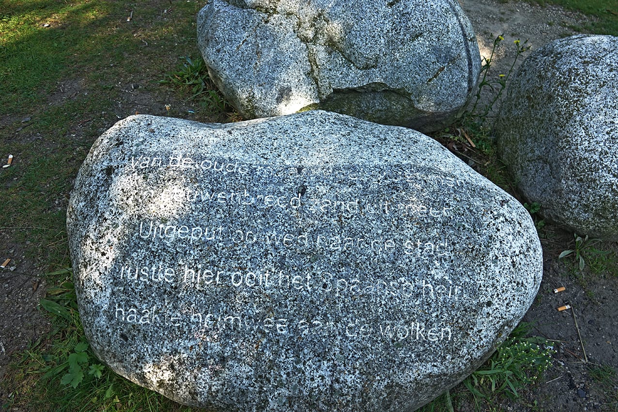 Poos place on the Warande in Gilze, with lines of poetry by Silva Ley. In the Eighty Years' War, a Spanish army bivouacked near this spot, during a siege of Breda.

Typical of Gilze are the small( now still) agricultural communities surrounding the village with names such as Bolberg, Horst, Besterd, Lange Reit, Vossenberg, Nerhoven and Verhoven.
The nearby sports park has 'Verhoven' as its name. This name refers to a group of farms (homesteads) further away. That 'further away' indicates the difference from nearby 'Nerhoven'.
More than once, excavations in the municipality of Gilze and Rijen have yielded impressive, archaeological finds, as you have read. Most recently in 2020; the remains of four farms and four wells from the time of Charlemagne.
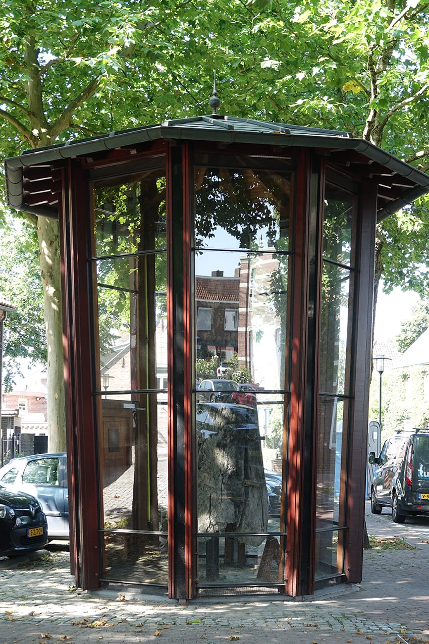
Water well in the centre of Gilze.
 Eating and drinking in the neighbourhood
 Fun tips in the area
Information on this page was made possible in part by Heemkring Molenheide, Tijdmachinegilzerijen.nl, Natuur- en Landschapsvereniging Gilze en Rijen (NLGR), Barbara Roozen and the municipality of Gilze en Rijen.
Sources: 'Field names in the municipality of Gilze and Rijen part I'; 'Gilze from Vossenberg to Valkenberg'; 'The historical canon of Gilze and Rijen'; Kwartaalblad De Mulder no 42.
